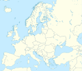
ܠܦܦܐ:Europe laea location map.svg
Appearance

Size of this PNG preview of this SVG file: 701 × 599 ܦܩܣܠ. Other resolutions: 281 × 240 ܦܩܣܠ | 561 × 480 ܦܩܣܠ | 898 × 768 ܦܩܣܠ | 1,198 × 1,024 ܦܩܣܠ | 2,395 × 2,048 ܦܩܣܠ | 1,401 × 1,198 ܦܩܣܠ.
ܠܦܦܐ ܫܪܫܝܐ (SVG file, nominally 1,401 × 1,198 pixels, file size: 2.21 MB)
ܬܫܥܝܬܐ ܕܠܦܦܐ
Click on a date/time to view the file as it appeared at that time.
| ܣܝܩܘܡܐ/ܙܒܢܐ | ܨܘܪܬܐ ܙܥܘܪܬܐ | ܩܝܡ̈ܐ | ܡܦܠܚܢܐ | ܥܘܩܒܐ | |
|---|---|---|---|---|---|
| ܗܫܝܐ | 22:57, 20 ܒܐܒ 2012 |  | 1,401 × 1,198 (2.21 MB) | McZusatz | Reverted to version as of 19:40, 10 March 2010 (...thumb fixed?) |
| 22:56, 20 ܒܐܒ 2012 |  | 1,401 × 1,198 (1.45 MB) | McZusatz | Reverted to version as of 18:44, 10 March 2010 (fixing thumb...) | |
| 19:40, 10 ܒܐܕܪ 2010 |  | 1,401 × 1,198 (2.21 MB) | Alexrk2 | +San Marino, enh. coastline & countries | |
| 18:44, 10 ܒܐܕܪ 2010 |  | 1,401 × 1,198 (1.45 MB) | Alexrk2 | == Summary == {{Information |Description= {{de|Positionskarte Europa; Politisch mit Staatsgrenzen, Inlandgewässer; Flächentreue Azimutalprojektion}} {{en|Location map Europe; Political with state boundaries, inland water; L |
ܡܦܠܚܬܐ ܕܠܦܦܐ
ܠܝܬ ܦܐܬܐ ܕܐܣܪ ܠܗܢܐ ܠܦܦܐ.
ܡܦܠܚܢܘܬܐ ܓܘܢܝܬܐ ܕܠܦܦܐ
The following other wikis use this file:
- Usage on als.wikipedia.org
- Usage on an.wikipedia.org
- Usage on av.wikipedia.org
- Usage on az.wikipedia.org
- Dunay
- Reyn
- UEFA Çempionlar Liqası 1994/1995
- UEFA Çempionlar Liqası 2007/2008
- Şablon:Yer xəritəsi Avropa
- Aqriate
- Akkona (səhra)
- Bardenas-Reales
- Pişinas
- Tabernas (səhra)
- Aleşkov qumları
- Mançester Arenada terror (2017)
- Avropa Gənclər Olimpiya Festivalı
- UEFA Çempionlar Liqası 2017/2018
- Yan çayı
- UEFA Çempionlar Liqası 2018/2019
- Moneqros səhrası
- UEFA Çempionlar Liqası 2019/2020
- UEFA Çempionlar Liqası 2020/2021
- UEFA Çempionlar Liqası 2021/2022
- Usage on ba.wikipedia.org
View more global usage of this file.


