
ܠܦܦܐ:NASA NorthSea1 2.jpg
ܥܓܪܐ ܕܓܠܚܐ: 458 × 599 ܦܩܣܠ. Other resolutions: 183 × 240 ܦܩܣܠ | 367 × 480 ܦܩܣܠ | 587 × 768 ܦܩܣܠ | 783 × 1,024 ܦܩܣܠ | 1,300 × 1,700 ܦܩܣܠ.
ܠܦܦܐ ܫܪܫܝܐ (1,300 × 1,700 ܦܩܣܠ، ܥܓܪܐ ܕܠܦܦܐ: 955 KB، ܐܕܫܐ ܕ MIME: image/jpeg)
ܦܣܝܩܬ̈ܐ
| Description |
Español: Imagen satélite de la NASA del mar del Norte
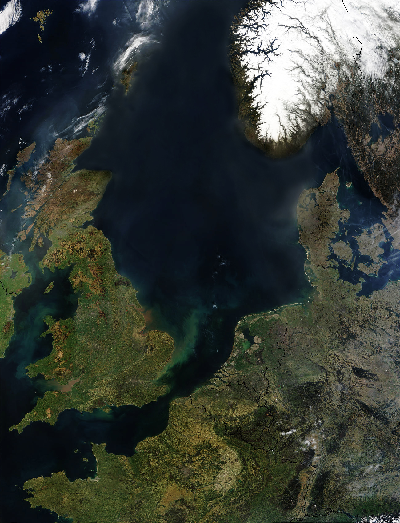
English: North Sea sattelite photo by NASA. The red dots are fires. This is a modified version without Sands of the Sahara above the North Sea.
Deutsch: Nordsee, NASA-Aufnahme. Saharasand über der Nordsee. Die roten Punkte markieren Feuer. Dies ist eine modifizierte Version ohne Sande der Sahara über der Nordsee.
Čeština: Družicový snímek; Červené body označují ohně.
Nederlands: Noordzee foto van NASA. De rode punten markeren branden. Dit is een bewerkte foto zonder zand van de Sahara boven de Noordzee. |
| ܣܝܩܘܡܐ | |
| ܡܒܘܥܐ |
|
| ܣܝܘܡܐ | MODIS Rapid Response Team, NASA/GSFC |
| Other versions |

.jpg)
ܦܣܣܐ
| This file is in the public domain in the United States because it was solely created by NASA. NASA copyright policy states that "NASA material is not protected by copyright unless noted". (See Template:PD-USGov, NASA copyright policy page or JPL Image Use Policy.) | ||
 |
Warnings:
|
ܬܫܥܝܬܐ ܕܠܦܦܐ
Click on a date/time to view the file as it appeared at that time.
| ܣܝܩܘܡܐ/ܙܒܢܐ | ܨܘܪܬܐ ܙܥܘܪܬܐ | ܩܝܡ̈ܐ | ܡܦܠܚܢܐ | ܥܘܩܒܐ | |
|---|---|---|---|---|---|
| ܗܫܝܐ | 11:17, 4 ܒܫܒܛ 2006 | | 1,300 × 1,700 (955 KB) | Merops | * '''Source''': http://visibleearth.nasa.gov/cgi-bin/viewrecord?25413 * first upload: April 7, 2004 - de:Wikipedia by user:Southpark {{PD-USGov-NASA}} |
ܡܦܠܚܬܐ ܕܠܦܦܐ
ܦܐܬܐ ܗܕܐ ܐܣܪ ܥܡ ܗܢܐ ܠܦܦܐ:
ܡܦܠܚܢܘܬܐ ܓܘܢܝܬܐ ܕܠܦܦܐ
The following other wikis use this file:
- Usage on af.wikipedia.org
- Usage on ar.wikipedia.org
- Usage on as.wikipedia.org
- Usage on azb.wikipedia.org
- Usage on bat-smg.wikipedia.org
- Usage on ba.wikipedia.org
- Usage on be.wikipedia.org
- Usage on bg.wikipedia.org
- Usage on bh.wikipedia.org
- Usage on bn.wikipedia.org
- Usage on bxr.wikipedia.org
- Usage on ce.wikipedia.org
- Usage on ckb.wikipedia.org
- Usage on cs.wikipedia.org
- Usage on cv.wikipedia.org
- Usage on da.wikipedia.org
- Usage on de.wikipedia.org
- Usage on de.wikinews.org
- Usage on diq.wikipedia.org
- Usage on dsb.wikipedia.org
- Usage on en.wikipedia.org
- Usage on en.wikinews.org
- Usage on en.wikiversity.org
- Usage on es.wikibooks.org
- Usage on et.wikipedia.org
- Usage on eu.wikipedia.org
- Usage on fa.wikipedia.org
- Usage on frr.wikipedia.org
- Usage on fr.wikipedia.org
- Usage on fy.wikipedia.org
- Usage on he.wikipedia.org
- Usage on hsb.wikipedia.org
- Usage on hu.wikipedia.org
- Usage on ilo.wikipedia.org
- Usage on it.wikipedia.org
- Usage on ja.wikipedia.org
- Usage on kcg.wikipedia.org
- Usage on kk.wikipedia.org
View more global usage of this file.