
ܠܦܦܐ:Dutch Municipality Haarlem 2006.png
ܠܝܬ ܢܩܕܘܬܐ ܝܬܝܪ ܡܢ ܗܢܐ.
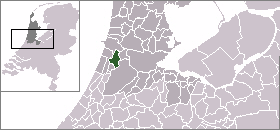
Dutch_Municipality_Haarlem_2006.png (280 × 130 ܦܩܣܠ، ܥܓܪܐ ܕܠܦܦܐ: 9 KB، ܐܕܫܐ ܕ MIME: image/png)

|
This file has been superseded by LocatieHaarlem.png. It is recommended to use the other file. Please note that deleting superseded images requires consent.
|
According to the author of the images nl:Gebruiker:Mtcv they are PD.
Modified by me, User:Joost (and kept inside the PD), to reflect the municipality borders anno 2006.
| I, the copyright holder of this work, release this work into the public domain. This applies worldwide. In some countries this may not be legally possible; if so: I grant anyone the right to use this work for any purpose, without any conditions, unless such conditions are required by law. |
ܬܫܥܝܬܐ ܕܠܦܦܐ
Click on a date/time to view the file as it appeared at that time.
| ܣܝܩܘܡܐ/ܙܒܢܐ | ܨܘܪܬܐ ܙܥܘܪܬܐ | ܩܝܡ̈ܐ | ܡܦܠܚܢܐ | ܥܘܩܒܐ | |
|---|---|---|---|---|---|
| ܗܫܝܐ | 20:21, 25 ܒܟܢܘܢ ܐܚܪܝ 2006 | | 280 × 130 (9 KB) | Joost~commonswiki | {{Dutch locator map}} According to the author of the images nl:Gebruiker:Mtcv they are PD. Modified by me, User:Joost (and kept inside the PD), to reflect the municipality borders anno 2006. |
ܡܦܠܚܬܐ ܕܠܦܦܐ
ܦܐܬܐ ܗܕܐ ܐܣܪ ܥܡ ܗܢܐ ܠܦܦܐ:
ܡܦܠܚܢܘܬܐ ܓܘܢܝܬܐ ܕܠܦܦܐ
The following other wikis use this file: