
ܠܦܦܐ:Nile delta landsat false color.jpg
ܥܓܪܐ ܕܓܠܚܐ: 800 × 600 ܦܩܣܠ. Other resolutions: 320 × 240 ܦܩܣܠ | 640 × 480 ܦܩܣܠ | 1,024 × 768 ܦܩܣܠ.
ܠܦܦܐ ܫܪܫܝܐ (1,024 × 768 ܦܩܣܠ، ܥܓܪܐ ܕܠܦܦܐ: 392 KB، ܐܕܫܐ ܕ MIME: image/jpeg)
ܦܣܝܩܬ̈ܐ
| Description |
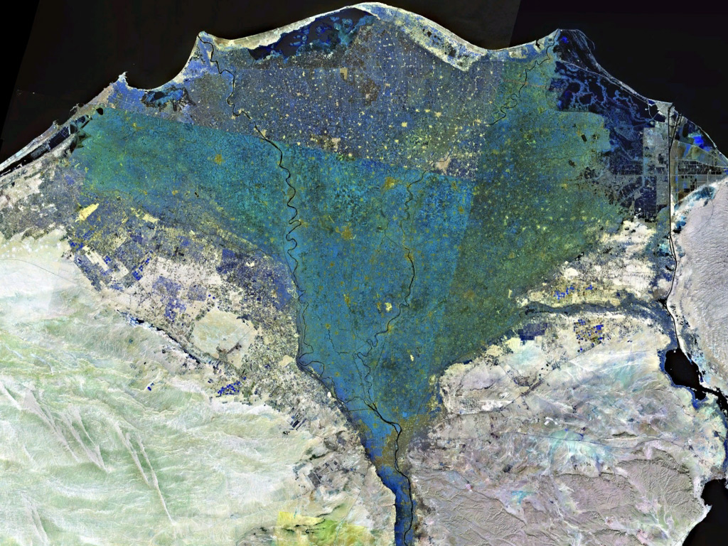
English: Landsat 7 false colour image of the Nile Delta |
|||
| ܣܝܩܘܡܐ | ||||
| ܡܒܘܥܐ | Captured and cropped from NASA World Wind. | |||
| ܣܝܘܡܐ | NASA | |||
| Permission (Reusing this file) |
|

ܬܫܥܝܬܐ ܕܠܦܦܐ
Click on a date/time to view the file as it appeared at that time.
| ܣܝܩܘܡܐ/ܙܒܢܐ | ܨܘܪܬܐ ܙܥܘܪܬܐ | ܩܝܡ̈ܐ | ܡܦܠܚܢܐ | ܥܘܩܒܐ | |
|---|---|---|---|---|---|
| ܗܫܝܐ | 21:20, 17 ܒܐܝܠܘܠ 2006 | | 1,024 × 768 (392 KB) | ChrisO | False colour image of the Nile Delta, taken by NASA's Landsat 7 satellite. {{PD-WorldWind}} |
ܡܦܠܚܬܐ ܕܠܦܦܐ
ܦܐܬܐ ܗܕܐ ܐܣܪ ܥܡ ܗܢܐ ܠܦܦܐ:
ܡܦܠܚܢܘܬܐ ܓܘܢܝܬܐ ܕܠܦܦܐ
The following other wikis use this file:
- Usage on ar.wikipedia.org
- Usage on av.wikipedia.org
- Usage on az.wikipedia.org
- Usage on be.wikipedia.org
- Usage on bh.wikipedia.org
- Usage on bs.wikipedia.org
- Usage on ca.wikipedia.org
- Usage on de.wikipedia.org
- Usage on en.wikipedia.org
- Usage on es.wikipedia.org
- Usage on fa.wikipedia.org
- Usage on fi.wikipedia.org
- Usage on he.wikipedia.org
- Usage on hr.wikipedia.org
- Usage on incubator.wikimedia.org
- Usage on io.wiktionary.org
- Usage on is.wikipedia.org
- Usage on it.wikipedia.org
- Usage on it.wikibooks.org
- Usage on it.wikiversity.org
- Usage on ja.wikipedia.org
- Usage on jv.wikipedia.org
- Usage on ka.wikipedia.org
- Usage on ko.wikipedia.org
- Usage on lmo.wiktionary.org
- Usage on lt.wikipedia.org
- Usage on ml.wikipedia.org
- Usage on ms.wikipedia.org
- Usage on nl.wikipedia.org
- Usage on no.wikipedia.org
- Usage on pl.wikipedia.org
- Usage on roa-tara.wikipedia.org
- Usage on ru.wikipedia.org
- Usage on sh.wikipedia.org
- Usage on simple.wikipedia.org
- Usage on sl.wikipedia.org
View more global usage of this file.