
ܠܦܦܐ:Kurdistan governorates 2012.png
ܥܓܪܐ ܕܓܠܚܐ: 643 × 600 ܦܩܣܠ. Other resolutions: 257 × 240 ܦܩܣܠ | 515 × 480 ܦܩܣܠ | 1,000 × 933 ܦܩܣܠ.
ܠܦܦܐ ܫܪܫܝܐ (1,000 × 933 ܦܩܣܠ، ܥܓܪܐ ܕܠܦܦܐ: 53 KB، ܐܕܫܐ ܕ MIME: image/png)
ܦܣܝܩܬ̈ܐ
| Description |
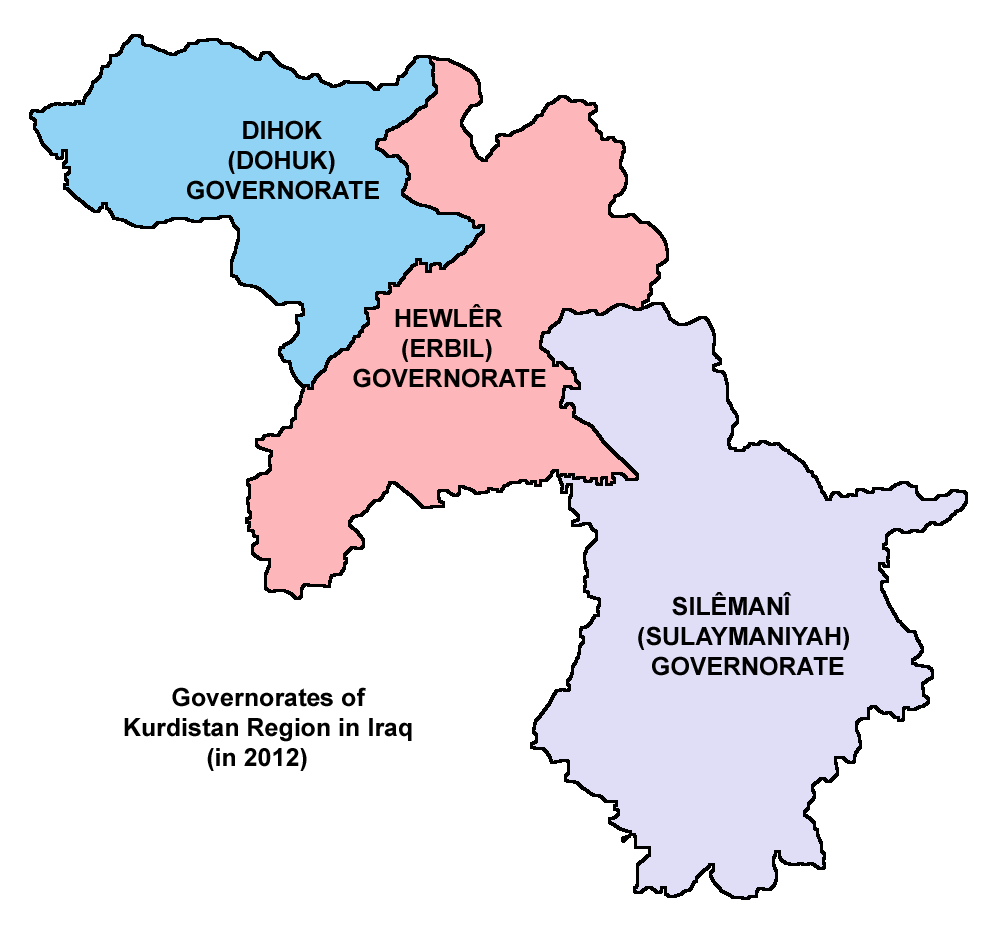
English: Map showing the governorates of Kurdistan Region in Iraq (in 2012). |
| ܣܝܩܘܡܐ | |
| ܡܒܘܥܐ | Own work |
| ܣܝܘܡܐ | PANONIAN |
ܦܣܣܐ
I, the copyright holder of this work, hereby publish it under the following license:
| This file is made available under the Creative Commons CC0 1.0 Universal Public Domain Dedication. | |
| The person who associated a work with this deed has dedicated the work to the public domain by waiving all of their rights to the work worldwide under copyright law, including all related and neighboring rights, to the extent allowed by law. You can copy, modify, distribute and perform the work, even for commercial purposes, all without asking permission.
|
Refences
Borders of Kurdistan Region governorates are made in accordance with these maps provided by the Kurdistan Region Statistics Office:
- http://www.krso.net/en/maps
- http://www.krso.net/documents/78/SubDistricts%20of%20the%20Governorates%20of%20Kurdistan%20Region.jpg
- http://www.krso.net/documents/38/Districts%20of%20the%20Governorates%20of%20Kurdistan%20Region.jpg
- http://www.krso.net/pdf/KRG-map-english.jpg
ܬܫܥܝܬܐ ܕܠܦܦܐ
Click on a date/time to view the file as it appeared at that time.
| ܣܝܩܘܡܐ/ܙܒܢܐ | ܨܘܪܬܐ ܙܥܘܪܬܐ | ܩܝܡ̈ܐ | ܡܦܠܚܢܐ | ܥܘܩܒܐ | |
|---|---|---|---|---|---|
| ܗܫܝܐ | 10:24, 6 ܒܐܝܠܘܠ 2014 | | 1,000 × 933 (53 KB) | PANONIAN | {{Information |Description ={{en|1=Map showing the governorates of Kurdistan Region in Iraq (in 2012).}} |Source ={{own}} |Author =PANONIAN |Date =2014 |Permission = |other_versions = }} |
ܡܦܠܚܬܐ ܕܠܦܦܐ
3 ܦܐܬܬ̈ܐ ܗܠܝܢ ܐܣܪܝܢ ܥܡ ܗܢܐ ܠܦܦܐ:
ܡܦܠܚܢܘܬܐ ܓܘܢܝܬܐ ܕܠܦܦܐ
The following other wikis use this file:
- Usage on arz.wikipedia.org
- Usage on be.wikipedia.org
- Usage on bg.wikipedia.org
- Usage on bn.wikipedia.org
- Usage on ca.wikipedia.org
- Usage on ckb.wikipedia.org
- Usage on cs.wikipedia.org
- Usage on cy.wikipedia.org
- Usage on da.wikipedia.org
- Usage on eo.wikipedia.org
- Usage on es.wikipedia.org
- Usage on et.wikipedia.org
- Usage on fr.wikipedia.org
- Usage on hi.wikipedia.org
- Usage on hu.wikipedia.org
- Usage on id.wikipedia.org
- Usage on it.wikipedia.org
- Usage on ja.wikipedia.org
- Usage on kk.wikipedia.org
- Usage on ko.wikipedia.org
- Usage on ku.wikipedia.org
- Usage on ms.wikipedia.org
View more global usage of this file.