
ܠܦܦܐ:Iraq (orthographic projection).svg

Size of this PNG preview of this SVG file: 600 × 600 ܦܩܣܠ. Other resolutions: 240 × 240 ܦܩܣܠ | 480 × 480 ܦܩܣܠ | 768 × 768 ܦܩܣܠ | 1,024 × 1,024 ܦܩܣܠ | 2,048 × 2,048 ܦܩܣܠ | 680 × 680 ܦܩܣܠ.
ܠܦܦܐ ܫܪܫܝܐ (SVG file, nominally 680 × 680 pixels, file size: 319 KB)
ܦܣܝܩܬ̈ܐ
| Description |
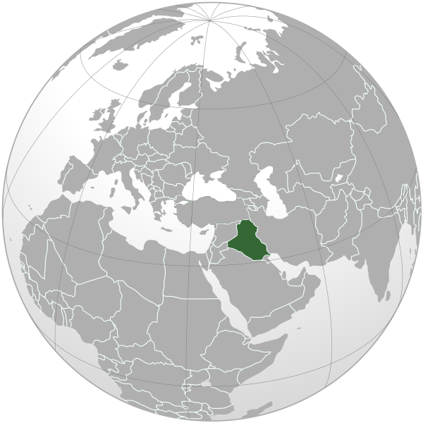
Čeština: Lokalizace Iráku v rámci světa (ortografická projekce). |
| ܣܝܩܘܡܐ | |
| ܡܒܘܥܐ | Own work |
| ܣܝܘܡܐ | |
| Other versions |
.svg) |
| SVG genesis | This W3C-invalid world map was created with Adobe Illustrator, and with Inkscape. |
.svg)
.svg)
.svg)
.svg)
.svg)
.svg)
.svg)
.svg)
.svg)
.svg)
.svg)
.svg)
.svg)
.svg)
.svg)
.svg)
.svg)
.svg)
.svg)
.svg)
.svg)
.svg)
.svg)
.svg)
.svg)
.svg)
.svg)
.svg)
.svg)
.svg)
.svg)
.svg)
.svg)
.svg)
.svg)
.svg)
.svg)
.svg)
.svg)
.svg)
.svg)
.svg)
.svg)
.svg)
.svg)
.svg)
.svg)
.svg)
.svg)
.svg)
.svg)
.svg)
.svg)
.svg)
.svg)
.svg)
.svg)
.svg)
.svg)
.svg)
.svg)
.svg)
.svg)
.svg)
.svg)
.svg)
.svg)
.svg)
.svg)
.svg)
.svg)
.svg)
.svg)

.svg)

.svg)

.svg)
.svg)
.svg)
.svg)
.svg)
.svg)
.svg)


.svg)
.svg)
.svg)
.svg)
.svg)
.svg)
.svg)

.svg)
.svg)
.svg)
.svg)
.svg)
.svg)
.svg)
.svg)
.svg)

.svg)
.svg)
.svg)
.svg)
.svg)
.svg)
.svg)
_without_national_boundaries.svg)
.svg)
.svg)
.svg)
.svg)
.svg)
.svg)

.svg)
.svg)
.png)
.svg)
.svg)
.svg)
.svg)

.svg)
.svg)
.svg)
.svg)
.svg)
.svg)
.svg)
.svg)
.svg)
.svg)
.svg)

.svg)
.svg)
.svg)
.svg)
.svg)
.svg)
.svg)
.svg)
.svg)

.svg)
.svg)

.svg)
.svg)
.svg)
.svg)
.svg)
.svg)
.svg)
.svg)
.svg)
.svg)
.svg)
.svg)
.svg)
.svg)
.svg)
.svg)
.svg)
.svg)
.svg)
.svg)
.svg)
.svg)
.svg)
.svg)
.svg)
.svg)
.svg)
_-_Crimea_disputed.svg)
.svg)
.svg)
.svg)
.svg)
.svg)
.svg)
.svg)
.svg)
.svg)
.svg)
.svg)
_political.svg)
.svg)
.svg)
.svg)
.svg)
_-_Crimea_disputed_-_no_borders.svg)
.svg)
.svg)
.svg)
.svg)
.svg)
.svg)
.svg)
.svg)
.svg)
.svg)
.svg)

.svg)
.svg)
.svg)

.png)
.svg)
.svg)
.svg)
.svg)
.svg)
.svg)
.svg)
.svg)
.svg)
.svg)
.svg)
.svg)
.svg)
.svg)
.svg)
.svg)
.svg)
.svg)
.svg)
.svg)
.svg)
.svg)
.svg)
.svg)
.svg)
.svg)
.svg)
.svg)
.svg)
.svg)
.svg)
.svg)
.svg)
.svg)
.png)
.svg)
.svg)
.svg)
_(orthographic_projection).png)
.svg)
ܦܣܣܐ
I, the copyright holder of this work, hereby publish it under the following license:
This file is licensed under the Creative Commons Attribution-Share Alike 3.0 Unported license.
- You are free:
- to share – to copy, distribute and transmit the work
- to remix – to adapt the work
- Under the following conditions:
- attribution – You must give appropriate credit, provide a link to the license, and indicate if changes were made. You may do so in any reasonable manner, but not in any way that suggests the licensor endorses you or your use.
- share alike – If you remix, transform, or build upon the material, you must distribute your contributions under the same or compatible license as the original.
ܬܫܥܝܬܐ ܕܠܦܦܐ
Click on a date/time to view the file as it appeared at that time.
.svg&dir=prev)
.svg&offset=20190116102903)
.svg&offset=&limit=20)
.svg&offset=&limit=50)
.svg&offset=&limit=100)
.svg&offset=&limit=250)
.svg&offset=&limit=500)
| ܣܝܩܘܡܐ/ܙܒܢܐ | ܨܘܪܬܐ ܙܥܘܪܬܐ | ܩܝܡ̈ܐ | ܡܦܠܚܢܐ | ܥܘܩܒܐ | |
|---|---|---|---|---|---|
| ܗܫܝܐ | 22:18, 3 ܒܐܕܪ 2020 | | 680 × 680 (319 KB) | Bidgee | Reverted to version as of 00:42, 3 March 2020 (UTC) per COM:OVERWRITE. Upload as a new file and do not overwrite existing ones |
| 12:44, 3 ܒܐܕܪ 2020 |  | 553 × 553 (290 KB) | SeifED23 | Reverted to version as of 19:42, 2 March 2020 (UTC) South Sudan is no longer part of Sudan since 2011 | |
| 00:42, 3 ܒܐܕܪ 2020 |  | 680 × 680 (319 KB) | Bidgee | Reverted to version as of 10:40, 16 January 2019 (UTC) per COM:OVERWRITE | |
| 19:42, 2 ܒܐܕܪ 2020 |  | 553 × 553 (290 KB) | SeifED23 | Reverted to version as of 11:16, 22 January 2019 (UTC) We don't remove South Sudan from the map of the location of Iraq | |
| 11:17, 22 ܒܟܢܘܢ ܐܚܪܝ 2019 |  | 680 × 680 (319 KB) | Nikki070 | Reverted to version as of 10:40, 16 January 2019 (UTC) | |
| 11:16, 22 ܒܟܢܘܢ ܐܚܪܝ 2019 |  | 553 × 553 (290 KB) | Nikki070 | Reverted to version as of 10:32, 16 January 2019 (UTC) | |
| 10:40, 16 ܒܟܢܘܢ ܐܚܪܝ 2019 |  | 680 × 680 (319 KB) | Bidgee | Reverted to version as of 05:45, 19 March 2015 (UTC) COM:OVERWRITE | |
| 10:32, 16 ܒܟܢܘܢ ܐܚܪܝ 2019 |  | 553 × 553 (290 KB) | Powerofgamers01 | Reverted to version as of 10:29, 16 January 2019 (UTC) | |
| 10:31, 16 ܒܟܢܘܢ ܐܚܪܝ 2019 |  | 680 × 680 (319 KB) | Powerofgamers01 | Reverted to version as of 05:45, 19 March 2015 (UTC) | |
| 10:29, 16 ܒܟܢܘܢ ܐܚܪܝ 2019 |  | 553 × 553 (290 KB) | Powerofgamers01 | Reverted to version as of 23:34, 16 March 2015 (UTC) |
ܡܦܠܚܬܐ ܕܠܦܦܐ
ܠܝܬ ܦܐܬܐ ܕܐܣܪ ܠܗܢܐ ܠܦܦܐ.
ܡܦܠܚܢܘܬܐ ܓܘܢܝܬܐ ܕܠܦܦܐ
The following other wikis use this file:
- Usage on ar.wikipedia.org
- العراق
- سلطة الائتلاف المؤقتة
- الانتداب البريطاني على العراق
- القوة البحرية العراقية
- الجمهورية العراقية الأولى
- العراق إبان حكم حزب البعث
- العلاقات الألمانية العراقية
- العلاقات المصرية العراقية
- العلاقات العراقية الصينية
- العلاقات البرازيلية العراقية
- مستخدم:مؤمل الجبوري
- العلاقات العراقية الهندية
- العلاقات العراقية البلغارية
- العلاقات العراقية الكوبية
- العلاقات الإيطالية العراقية
- العلاقات العراقية الصربية
- العلاقات السويدية العراقية
- العلاقات العراقية البريطانية
- مستخدم:ثعلب شبه الجزيره/العراق
- نقاش المستخدم:ثعلب شبه الجزيره/العراق
- مستخدم:Turkmen oglu/صناديقي
- مستخدم:Bassammahdi
- مستخدم:MohammadHuzam
- بوابة:العالم الإسلامي/دولة مختارة/أرشيف
- بوابة:العالم الإسلامي/دولة مختارة/4
- قائمة ثدييات العراق
- قائمة الدول ذات السيادة والأقاليم التابعة في آسيا
- ويكيبيديا:مقالة الصفحة الرئيسية المختارة/433
- مستخدمة:Hadeelhh
- مستخدمة:Hadeelhh/صناديقي
- مستخدم:صفاء/صناديقي
- مستخدم:صندوق مستخدم/مستخدم شارك في مشروع ويكي العراق
- معاملة المثليين في العراق
- مستخدم:جار الله/قائمة صور مقالات العلاقات الثنائية
- العلاقات الأنغولية العراقية
- العلاقات العراقية الكورية الجنوبية
- العلاقات العراقية الإريترية
- العلاقات العراقية السويسرية
- العلاقات العراقية الليختنشتانية
- العلاقات العراقية البوليفية
- العلاقات العراقية الموزمبيقية
- العلاقات الألبانية العراقية
- العلاقات العراقية البلجيكية
- العلاقات العراقية الإثيوبية
- العلاقات العراقية الطاجيكستانية
- العلاقات العراقية الرومانية
- العلاقات الأرجنتينية العراقية
- العلاقات العراقية الغامبية
- العلاقات العراقية القبرصية
- العلاقات العراقية السيراليونية
View more global usage of this file.
.svg)
.svg)